THANK YOU FOR SUBSCRIBING
Be first to read the latest tech news, Industry Leader's Insights, and CIO interviews of medium and large enterprises exclusively from Gov CIO Outlook
THANK YOU FOR SUBSCRIBING

By
Government CIO Outlook | Tuesday, October 27, 2020
Stay ahead of the industry with exclusive feature stories on the top companies, expert insights and the latest news delivered straight to your inbox. Subscribe today.
The use of satellite technologies in disaster and emergency management has been vital in timely allocation, evaluation, containment, and risk mitigation.
FREMONT, CA: Satellite technology is an indispensable part of modern life. This technology is contributing to global socio-economic development and connecting people across the globe. It is also used to address a range of global issues like preserving the environment, monitoring climate change, protecting biodiversity, managing the weather, offering telemedicine services, and managing agricultural activities. Satellite technologies also have an essential role in emergency and disaster management and supporting work to contain the spread of the COVID-19 pandemic. Read on to know more.
[vendor_logo_first]There is great potential for applying space-related systems to evaluating damage and the situation on the ground after natural and technological disasters. Rapid mapping and high-resolution imaging have become virtual support devices in emergency relief operations. Awareness and understanding of satellite applications' advantages for emergency management, beyond the satellite systems devoted to weather forecasting, have grown significantly. Satellite maps and Geographic Information Systems (GIS) are used in emergency response and humanitarian relief, including for staff security, logistics, distribution, transport, and telecommunication networks.
The use of disaster management satellite intelligence can help local authorities, governments, emergency services, and environmental agencies. The high spatial and temporal resolution satellite imagery applications, from forest fire detection to satellite flood monitoring, provide an adequate response when disaster hits. It also provides very high-resolution satellite data and processing services to government agencies managing disaster response in natural and urban environments, identifying, preparing, and planning for threats and emergencies, and responding rapidly to crises as they occur.
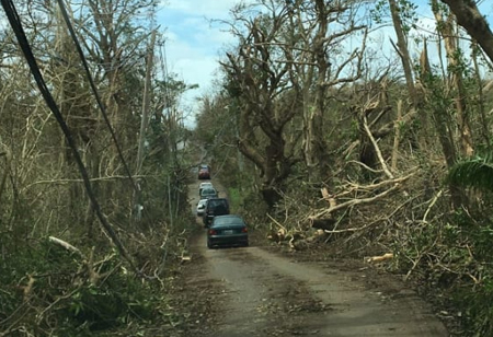
A significant problem derives from the difficulty of locating and reaching affected villages during emergencies. Satellite maps help agencies see levels of destruction and check roads' condition, thereby enabling them to identify obstacles to access and prioritize their activities efficiently. Offering relief was still complicated, but it would have been even more so without the help of geographic information. This information enables an overview of the disaster impact long before data became available from assessment missions on the ground, saving precious time and effort.
See Also: Top GIS Consulting/Services Companies
I agree We use cookies on this website to enhance your user experience. By clicking any link on this page you are giving your consent for us to set cookies. More info


